West Side of the Harbor – early center of activity
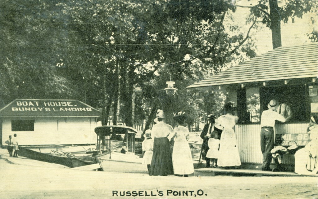
Bundy’s Landing was located on the west bank of the harbor, next to the Hotel Russells Point.
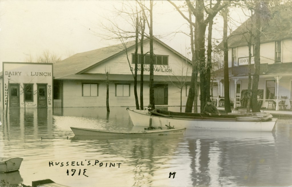
The Great Flood of 1913 occurred between March 23 and March 26, after major rivers in the central and eastern United States flooded from runoff and several days of heavy rain. Around Indian Lake, flooding occurred in Lakeview but also in Russells Point, as evidenced by this postcard. Since then, flooding has continued to plague the lake region, even after the recent rebuilding and heightening of the Waste Weir.
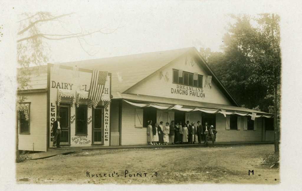

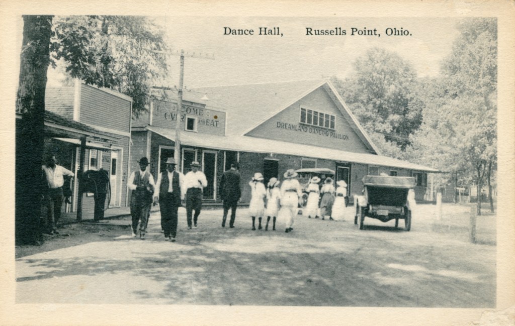
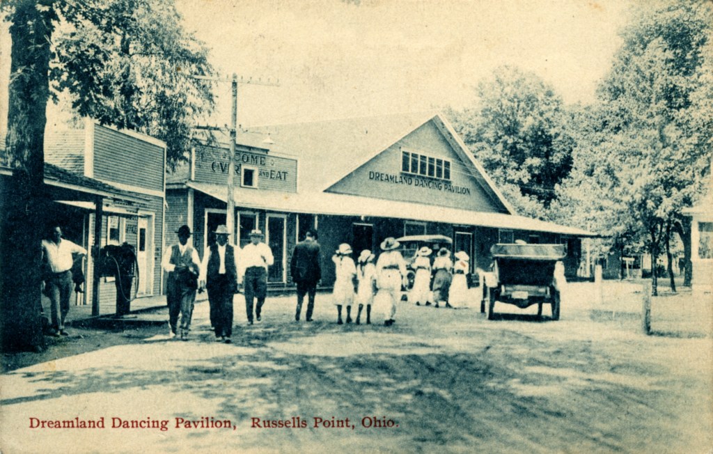
In 1911, Mr. A. B. Jones purchased Morris Bundy’s Resort on the west side of the harbor in Russells Point and enlarged the hotel, constructed a grocery store and a Post Office that was open during the summer only. Mr. Jones also built the first dance hall, the Dreamland Dancing Pavilion.
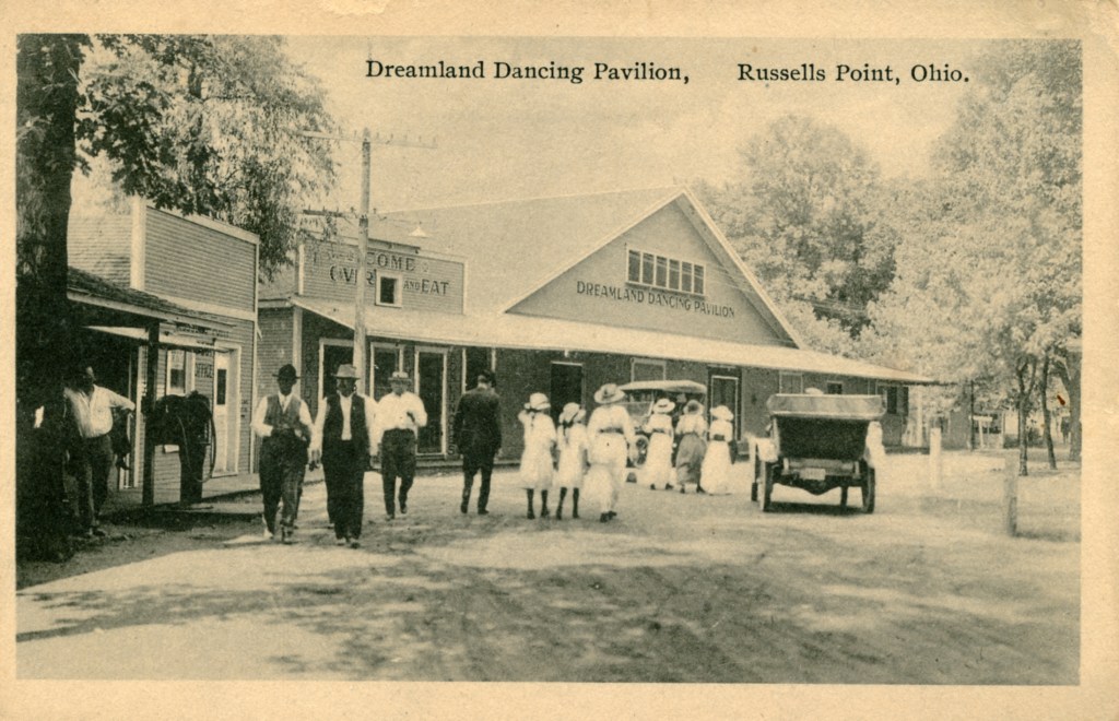
Postcards dated 1916 (left) and 1917 (right).
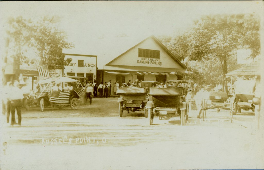
Fourth of July celebrations in Russells Point.
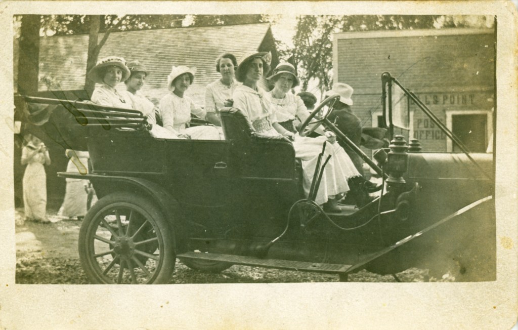
Undated photograph showing a group of women posing in their automobile in front of the post office.
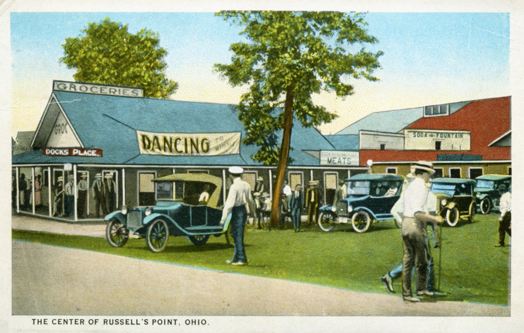
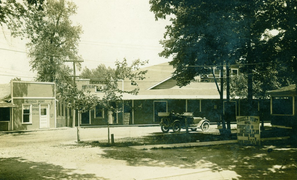
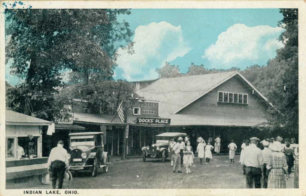
This 1926 postcard is titled “The Center of Russell’s Point” and shows from left to right the grocery store, the post office and soda-and-fountain stand called “Dock’s Place” on earlier postcards; to the extreme right the roof of the Dreamland Dance Pavilion is visible. The road in the foreground is Main Street.
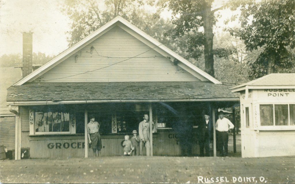
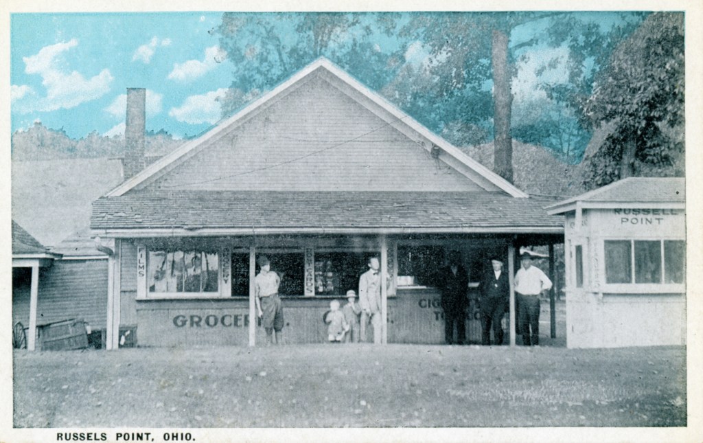
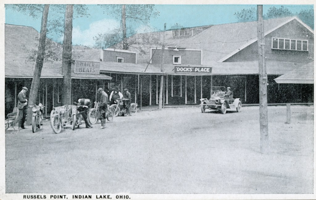
Grocery store on the north side of Main Street on the west side of the harbor. A second grocery store was a short distance to the east, on the south side of Main Street.
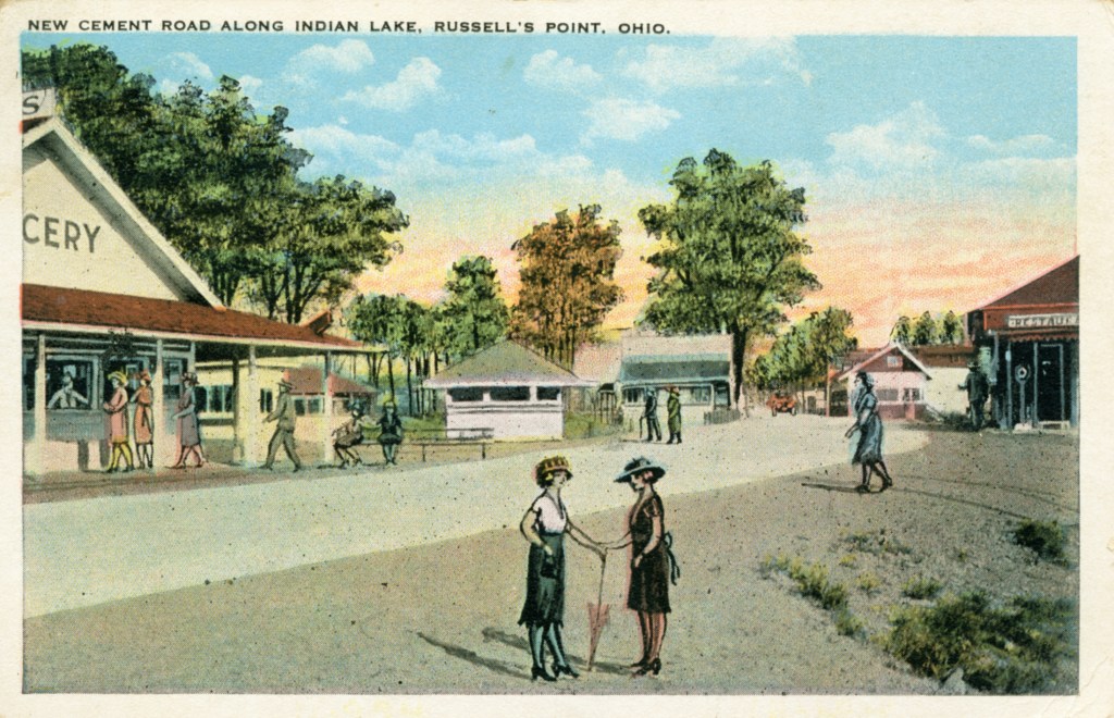
The first concrete or cement road in the Indian Lake area was U.S. Route 33 – now State Route 366. The first stretch was built in 1921 from the Auglaize County line to Lakeview. A second section ran from the waste weir to Lakeview. In the early 1920s a new cement road was big news for the community and celebrated with postcards such as the one shown here. In June, 1926, the Lima News raved about the “excellent concrete road extending from Lakeview to Russells Point and for hundreds of miles in both directions from those towns. A series of lights are being installed high above the heads of the occupants of speeding automobiles.” The age of the automobile had arrived!
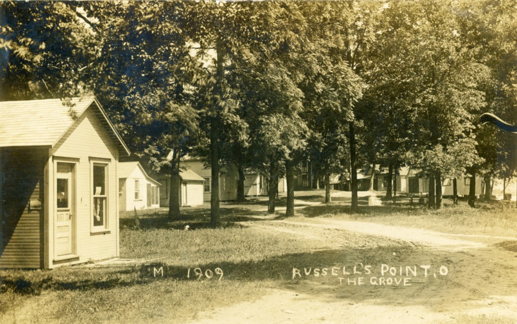

Postmarked 1913, the postcard on the right shows the studio of Harry Mansfield, one of the photographers who photographed many scenes around Indian Lake in the first decade of the twentieth century. To the right of the studio, people are congregating outside of a building from which an American Flag is flying. The smaller flag on the same pole appears to be of the Indian Lake Yacht Club. Perhaps this photograph shows an early July Fourth celebration. The postcard on the left dates from 1909 and was taken by Harry Mansfield and shows the same view called “The Grove.”

According to the Logan County Digital Collection “The Grove” refers to cottages on Wilgus Street.
